Hello, eco-conscious friends and infrastructure enthusiasts! Today, we’re diving into the fascinating world of Wastewater GIS Integration. If you’ve ever wondered how technology is revolutionizing the management and sustainability of our water resources, you’re in for a treat!
What is Wastewater GIS Integration?
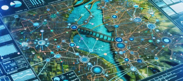
Geographic Information Systems (GIS) have been a game-changer for many industries, and the wastewater sector is no exception. Wastewater GIS Integration entails merging geographical data with wastewater management information to create a comprehensive, spatially-aware system. This integration allows for a more intelligent approach to wastewater treatment and infrastructure management. 🌐💧
The Benefits: Why GIS in Wastewater?
- Improved Efficiency: By visualizing wastewater systems in a geographic context, operators can pinpoint issues rapidly and deploy resources more effectively.
- Better Planning: GIS can help planners design wastewater infrastructure that minimizes environmental impact and considers future growth.
- Enhanced Monitoring: With GIS, it’s easier to monitor system performance and track changes over time, leading to a healthier ecosystem.
- Data-Driven Decisions: The integration of GIS data with real-time wastewater analytics aids in making informed decisions.
Real-World Applications
Wastewater GIS Integration isn’t just a theoretical concept—it’s being successfully applied across the globe. Here’s how:
- Asset Management: Mapping underground pipes, treatment facilities, and pumps to ensure efficient operation and maintenance.
- Leak Detection: Identifying potential leaks by analyzing spatial patterns and anomalies in the system.
- Environmental Protection: Assessing the potential impact of discharges on natural water bodies and devising strategies to minimize harm.
Challenges and How to Overcome Them
Despite the clear benefits, integrating GIS into wastewater systems isn’t without its hurdles. Concerns about data accuracy, interoperability of different systems, and the expertise required for operation must be addressed. However, with advancements in technology and a growing pool of GIS-proficient professionals, these challenges are steadily being overcome.
To get started, stakeholders can consult with industry experts, participate in specialized training programs, and attend webinars focused on wastewater GIS techniques and technologies.
Wrapping Up
The integration of GIS into wastewater management is reshaping the way we look after our water systems for the better. With this smart approach, we can aspire to a future where water resources are managed more sustainably, efficiently, and responsibly.
Here are a few resources to further your understanding of Wastewater GIS Integration:
- Environmental Protection Agency (EPA) – Wastewater Technology Fact Sheet
- American Water Works Association (AWWA) – Resource Community on Wastewater
- Esri Water Resources – GIS Solutions for Water, Wastewater, and Stormwater
If you have questions, ideas, or stories about wastewater GIS Integration, drop a comment below. Let’s keep the conversation flowing! 💬💦