Hello, eco-conscious friends and wastewater warriors! Have you ever wondered how cities manage the complex networks that whisk away everything we flush and rinse down the drains? Today, we dive into the crucial yet often overlooked world of Wastewater GIS Integration—a tech-savvy solution that’s changing the game in environmental management.
What is GIS?
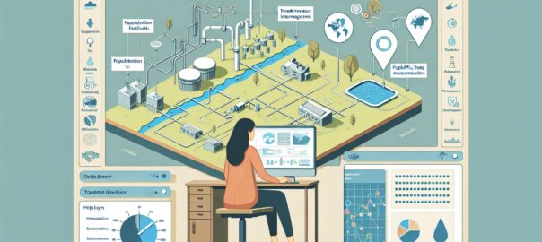
Geographic Information Systems (GIS) are powerful tools used to capture, analyze, and visualize spatial data. By understanding the physical locations and layouts of various objects and features on Earth, GIS enables users to create detailed maps and models, making it easier to make informed decisions in various fields, including urban planning, natural resource management, and, you guessed it, wastewater management!
Mapping the Unseen: The Role of GIS in Wastewater Management
But what does GIS have to do with wastewater? A ton! Wastewater management is an intricate ballet of pipes, pumps, and treatment facilities. By integrating GIS technology, utility companies and city planners can create a comprehensive and dynamic map of the wastewater infrastructure.
With GIS Integration, Here’s What You Can Do:
– Visualize Complex Systems: This means seeing everything from the vast network of sewer pipes hidden beneath our feet to the locations of treatment plants and pumping stations.
– Data Analysis: Want to know which areas are more prone to sewer overflows during heavy rains or where infrastructure is aging and needs attention? GIS crunches the numbers and spatial data to provide these insights.
– Maintenance and Upgrades Planning: GIS helps prioritize where and when to perform maintenance or upgrades, saving time and money, and reducing the environmental impact of avoidable spills or leaks.
– Emergency Response: When things do go wrong, a GIS-powered map can guide emergency crews directly to the problem’s source much faster than traditional methods.
Real-World Applications
Cities like Washington, D.C. and Cincinnati, Ohio have adopted wastewater GIS integration with impressive results. These systems help manage millions of gallons of sewage, ensuring they’re treated and returned to the environment safely and efficiently.
The Benefits of Wastewater GIS Integration
- Improved Operational Efficiency: GIS cuts down on guesswork and allows for precise planning.
- Enhanced Environmental Protection: Accurate data means fewer accidents and better protection for our waterways.
- Cost Savings: By optimizing operations, cities can save big bucks in the long term.
- Public Health: Ensuring a reliable sewage system safeguards the community from potential health risks.
Embracing the High-Tech Treatment
By bringing together GIS with wastewater management, we’re not just treating water; we’re treating entire communities to healthier, more sustainable futures. If you’re interested in learning more, there are some incredible resources and case studies available from:
– The Environmental Protection Agency (EPA)
– Water Environment Federation (WEF)
– ArcGIS Solutions for Water
Remember, each one of us plays a part in using water responsibly and protecting our precious water resources. With technologies like GIS in our toolkit, we’re better equipped than ever to keep our planet blue and beautiful.
So here’s to the unsung heroes of the underground—the tech-savvy wizards of wastewater GIS integration! Let’s continue to support this vital work, ensuring it flows smoothly for generations to come.
Until next time, keep on mapping your world for a cleaner, greener tomorrow! 🌍💧🗺️